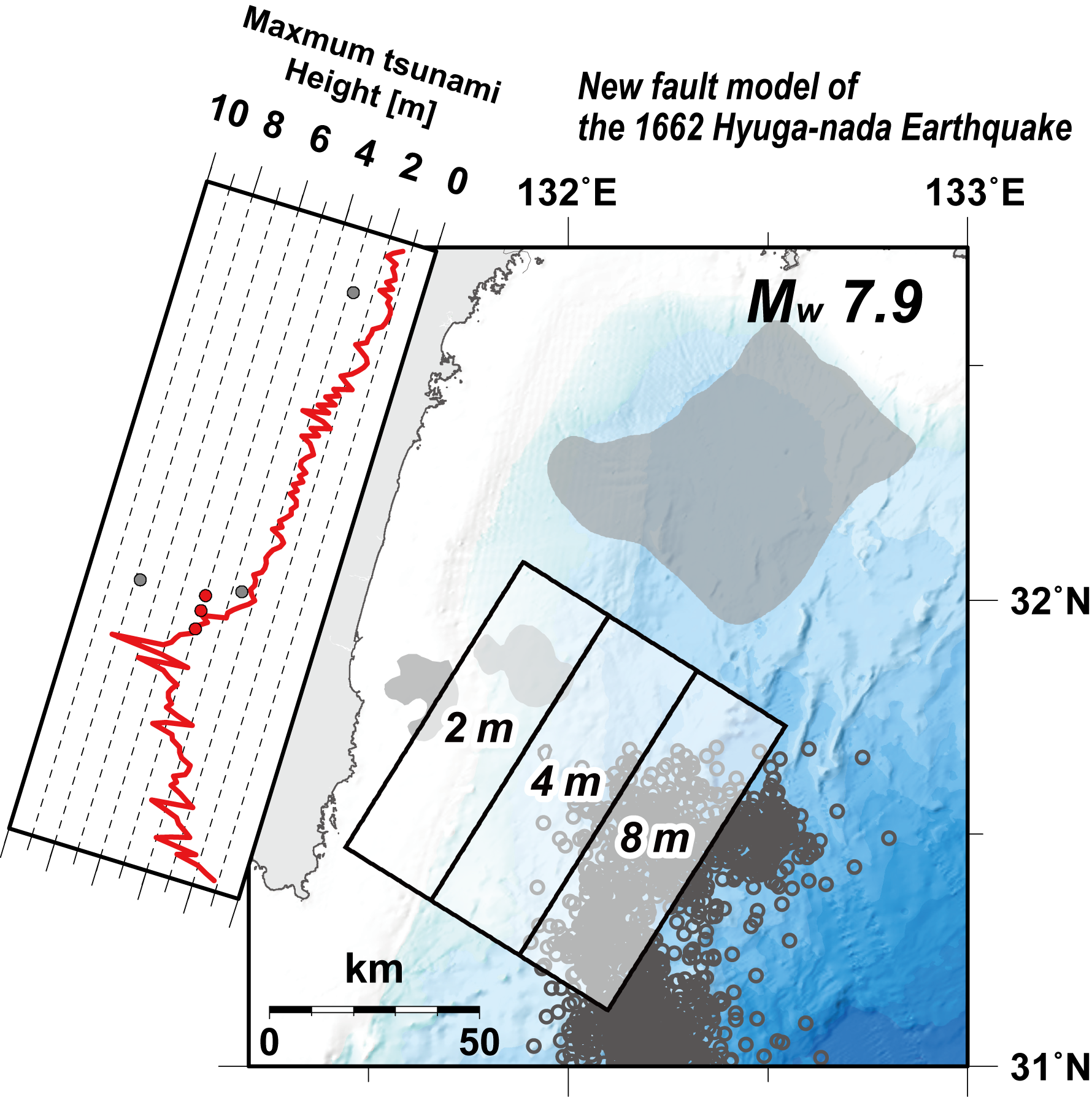
The 1662 Hyuga-nada Earthquake is one of the largest earthquakes to have occurred in the Hyuga-nada region, Southwest Japan, rupturing the western part of the Nankai Trough subduction zone. Strong ground motion and a large tsunami with an estimated height of at least 4–5 m were reported along the coast of Miyazaki Prefecture, Kyushu Island, with extensive damage reported across this region. Therefore, developing a more complete picture of the 1662 Hyuga-nada Earthquake will improve our understanding of tsunami risk along the Pacific coast of Southwest Japan. Here we use the most recent geophysical data from the region to propose a novel source model for the 1662 Hyuga-nada Earthquake that incorporates our current understanding of the interactions between slow earthquakes and great earthquakes. The source area in our proposed model extends from the focal region of recurrent M7-class interplate earthquakes to the region of slow earthquakes that occur at relatively shallow depths along the plate boundary. Tsunami simulations indicate that the predicted coastal tsunami heights are broadly compatible with previously reported tsunami heights. This new model suggests that the 1662 Hyuga-nada Earthquake was probably a M8-class earthquake, and that previous magnitude determinations may have underestimated the strength of this historic earthquake. However, the model uncertainty remains large, and the calculated tsunami heights for the southern coast of Miyazaki Prefecture are very high. We suggest that future verification, including an analysis of tsunami-related deposits along the coast, will be important to more accurately determine the source area of the 1662 Hyuga-nada Earthquake.